Steep hikes in the Wasatch Range
The Grand Teton trip required significant hiking with a 35-40# pack. We explored the possibility of doing the Cathedral Traverse, which would involve climbing Teewinot. This hike is very steep, a gain of 5524 ft in only 2.95 miles--a grade of 35% (1873 feet/mile).
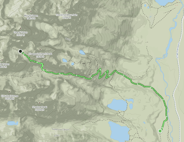
Ultimately, we decided to climb the Grand via the Lower Saddle, starting at the climber's ranch at an elevation of 6700 ft. From there, we hiked to the Moraines Campground at 10,800 feet over a distance of 6.06 miles. This route had a much more manageable grade of 13% (676 feet/mile).
I created this GPX file using the amazing (and free!) GPX Studio, which I then uploaded to my AllTrails account here.
 .
.
To prepare for the trip, I collected some steep hikes in the Wasatch Range. Our favorite was the Snowbird hike, since we could take the tram down and do a second lap on the same day.
| Hike | elevation (feet) | length (miles) | feet / mile |
|---|---|---|---|
| Mount Superior | 2555 | 1.05 | 2433 |
| Provo Peak trail | 2677 | 1.35 | 1983 |
| Teewinot (Tetons - for reference) | 5524 | 2.95 | 1873 |
| Cascade Mountain via Upper Pole Couloir | 3330 | 1.9 | 1753 |
| Grandeur Peak Trail (West Face) | 3238 | 2.2 | 1472 |
| Mahogony Mt | 3786 | 2.7 | 1402 |
| Broads Fork | 5246 | 4.3 | 1220 |
| Olympus | 4097 | 3.45 | 1188 |
| Snowbird hidden peak | 2753 | 2.48 | 1110 |
| Sundial | 4130 | 4.9 | 843 |
| Mt Raymond | 4163 | 5.1 | 816 |
| Lake Blanche | 2811 | 3.5 | 803 |
| Climber's Ranch to Moraines (Tetons) | 4098 | 6.06 | 676 |